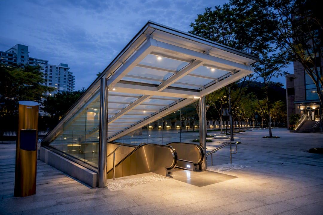
Circle Line Stage 6 opened for passenger service on July 12, 2026, adding three new stations: Keppel (CC30), Cantonment (CC31), and Prince Edward Road (CC32). The Circle Line is now a closed loop of 33 stations spanning 39.5 kilometers, the first of its kind in Singapore. For commuters, that means direct travel between the southwestern and southeastern parts of the island without funneling through a city-center interchange.
TL;DR:
- The addition of three stations completes the Circle Line loop, increasing its length to 39.5 kilometers and total stations to 33, with renumbered and retired station codes.
- Trains now run continuously in both directions around the full loop, requiring checking platform displays and adjusting old route assumptions for accurate trip planning.
- The stations were designed with barrier-free features, heritage elements, and practical amenities like bicycle parking and sheltered walkways, enhancing commuter convenience.
- The line's full loop reduces the need for transfers, cutting travel time for many routes and potentially lowering fares depending on the journey distance.
- The completion of the loop accelerates neighborhood development perceptions, particularly facilitating access to the Greater Southern Waterfront and Marina Bay areas for property buyers.
Table of Contents
- What Changed on the Circle Line Map
- How Trains Run Now: Loop Operations Explained
- Station Design and Accessibility at the New Stations
- Why Stage 6 Took So Long to Build
- What This Means for Your Daily Commute
- Will Fares Change Because of the New Stations?
- Connecting to Buses and Other MRT Lines
- Why This Loop Matters Beyond the Commute
- Living Near the Loop: What Aurea Offers Nearby
- Sources
- FAQ
What Changed on the Circle Line Map
The three new stations slot into the existing line between HarbourFront and Marina Bay, closing a gap that had split the Circle Line into a semicircle since it opened in phases starting in 2009. Here's what each station brings to the network and how it changes your route.
Keppel (CC30) sits near Keppel Road, roughly 20 meters below ground, close to the Greater Southern Waterfront and the old PSA port precinct. A 24-hour underpass connects its entrances, which matters if you're moving between the station and nearby developments after regular operating hours. It is the station most directly tied to the waterfront redevelopment that officials have been talking about for years.
Cantonment (CC31) is built beneath the site of the former Tanjong Pagar Railway Station, one of Singapore's most recognizable heritage buildings. At about 28 meters deep, it's a substantial dig, and the design team worked heritage elements from the old railway station into the finishes and entrance treatments rather than paving over the history entirely.
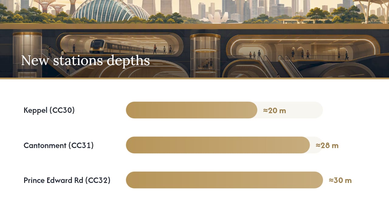
Prince Edward Road (CC32) goes even deeper, close to 30 meters, serving the Shenton Way office corridor. Its entrances connect commuters to landmarks including the Hock Teck See Temple and Masjid Haji Muhammad Salleh, so if you work in that stretch of the financial district, this station probably just became your new front door.
The completed loop also triggered a renumbering exercise you'll notice on updated maps and platform signage:
- Marina Bay and Bayfront stations were renumbered into the CC33/CC34 sequence to reflect their new position in a closed loop rather than a line with two open ends.
- The old "CE" station codes, used for the short Marina Bay extension that ran as a separate branch, have been retired now that those stations sit inside the main loop.
- The line's total length grew from roughly 35.7 kilometers to 39.5 kilometers with the addition of the three stations.
- Total station count across the Circle Line rose to 33, according to the Land Transport Authority.
If you've used the Circle Line for years, the mental map you built around HarbourFront as one end and Dhoby Ghaut as the other no longer applies. There isn't really an "end" anymore. There's just the loop, running in two directions.
How Trains Run Now: Loop Operations Explained
Trains now run in two continuous directions around the full loop: clockwise and anticlockwise, rather than the point-to-point service you were used to. That single change affects almost everything about how you should read a platform display or plan a transfer.
Short-working services haven't disappeared, though. Some trains still terminate early, particularly around the Dhoby Ghaut spur and at Prince Edward Road, to manage capacity on different segments of the loop without running every single train the full distance. This matters because two trains can arrive on the same platform heading in the same general direction, but one goes all the way around and the other stops partway.
Here's how to avoid getting caught out:
- Check the digital display before boarding. It shows whether the approaching train terminates at a specific station or continues around the loop.
- Note the direction indicator, clockwise or anticlockwise, rather than trying to think in terms of "towards HarbourFront" the way you might have before.
- If you're heading to an interchange station, confirm it's listed as the next major stop on the display rather than assuming based on your old mental map of the line.
- Build in a buffer of a few extra minutes for your first few trips until the new patterns feel automatic.
LTA deployed 23 additional trains to support the higher capacity a full loop demands. Deliveries began arriving from March 2022, with the expanded fleet introduced into active service starting in April 2026, ahead of the CCL6 opening. More trains in circulation means shorter waits between services during peak hours, which matters more on a loop line than it did on the old open-ended configuration, since trains now need to maintain frequency across a longer total route.
LTA also revised the wayfinding signage across the network before CCL6 opened, rolling out changes at stations including Buona Vista, Esplanade, Paya Lebar, and Promenade. The new signs use larger fonts, drop some of the older icon-based cues, and put more emphasis on naming the next interchange or the train's terminus directly. It's a small design change with a real practical payoff: less squinting at a tiny icon, more just reading the word that tells you where the train is actually going.
Station Design and Accessibility at the New Stations
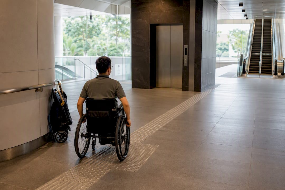
Each of the three new stations was built barrier-free from day one, with lifts, tactile guidance paths, and escalators at every entrance. That's standard for new MRT construction in Singapore, but it's worth confirming if you're planning a first visit with a wheelchair, a stroller, or mobility challenges, since entrance counts and lift placement vary station to station.
Keppel (CC30) leans into its port surroundings with design cues borrowed from shipping and maritime industry, including color choices and ventilation detailing that echo the container terminals nearby. Cantonment (CC31) keeps its heritage connection visible, working the character of the old Tanjong Pagar Railway Station into finishes rather than hiding it behind a generic modern shell. Prince Edward Road (CC32) carries maritime references as well, appropriate given its proximity to the waterfront corridor that runs along this stretch of the city.
Beyond the platforms themselves, commuters get a few practical extras:
- Bicycle parking at select entrances, useful if you're combining a short ride with the train for the last stretch of your commute.
- Sheltered walkways connecting some entrances to nearby office and residential developments, which matters a lot more than it sounds during Singapore's frequent downpours.
- The 24 hour underpass at Keppel, giving pedestrians a way through the station area even outside train operating hours.
- Smart lighting and motion-sensor controls in less-trafficked areas, part of LTA's broader push toward more energy-efficient station operations.
Pro Tip: If you're new to any of the three CCL6 stations, check which entrance is closest to your actual destination before you arrive. Depths of 20 to 30 meters mean a wrong entrance choice can add several minutes of walking underground before you even reach the platform.
Why Stage 6 Took So Long to Build
LTA first announced Circle Line Stage 6 back in 2013, over a decade before trains actually started running through the new stations. The delay wasn't a case of stalled construction. It came down to land availability. Tanjong Pagar Railway Station needed to be formally handed back before Cantonment could be built beneath it, and the broader port operations along the waterfront needed to relocate to Tuas before the Greater Southern Waterfront land could be freed up for station construction and future redevelopment.
Once construction was underway, the engineering challenges were substantial in their own right:
- Contracts were awarded in phases, with tunneling and station excavation proceeding at different rates depending on land access and soil conditions at each site.
- Excavation depths ranging from roughly 20 to 30 meters required significant tunnel strengthening work in places, particularly given the dense urban environment above.
- Heritage conservation requirements at the Tanjong Pagar Railway Station site added complexity that a greenfield station wouldn't have faced.
- Final testing and commissioning led into a public preview on July 4, 2026, when LTA opened the three stations for free travel before full passenger service began eight days later on July 12.
Acting Minister for Transport Jeffrey Siow noted at the preview event that CCL6 caps off a planning process stretching back roughly 30 years, and framed the completed loop as a catalyst for further development across the Greater Southern Waterfront and Marina Bay.
What This Means for Your Daily Commute
The clearest win from CCL6 is the trips it eliminates. If you used to travel from somewhere near HarbourFront to somewhere near the eastern side of the Circle Line, you probably transferred through a city-center interchange like Dhoby Ghaut or Bishan. Now, for a meaningful share of those journeys, you can just stay on the loop.
LTA estimates more than 10,000 commuters will benefit daily from the direct connection the new stations create between the southwest and southeast of the island. That's not a projection based on hope. It reflects the travel patterns LTA already sees on adjacent segments of the network.
A few tips for planning trips on the newly closed loop:
- Pick your destination's nearest interchange first, then work backward to figure out whether you need clockwise or anticlockwise service.
- Use a transit app rather than relying on memory for the first few weeks. Loop directionality doesn't map cleanly onto the mental shortcuts most commuters built up over years of point-to-point travel.
- Watch the platform display for terminating trains specifically if you're heading toward Prince Edward Road or through the Dhoby Ghaut spur, since not every train on the platform completes the full loop.
- Give yourself a small buffer during the first week or two. Wayfinding changes take a few trips to become second nature, even for commuters who've used the Circle Line for years.
Pro Tip: Screenshot the updated Circle Line map and keep it handy on your phone for your first week of travel through the new stations. Muscle memory from the old line layout will actively work against you until the loop clicks.
Will Fares Change Because of the New Stations?
Adding new stations to a network typically triggers questions about whether trips will cost more, and the honest answer is that fares in Singapore follow a distance-based structure administered through the Public Transport Council, not a flat per-line rate that would change simply because a line got longer.
In practice, that means your fare for any given trip depends on the actual distance traveled, calculated automatically when you tap in and tap out with your EZ-Link card, bank card, or SimplyGo-linked device. Since CCL6 shortens many routes by removing the need for a city-center transfer, some trips could actually work out cheaper simply because the straight-line distance through the loop is shorter than the old detour through an interchange station.
There's no indication of a special surcharge or new fare category tied specifically to the three new stations. The safest approach, especially in the weeks right after a major line change, is to check the current fare for your specific route using the official fare calculator before you travel, rather than assuming your old commute's price still applies exactly. If your trip pattern has changed because you're no longer transferring through the city center, your fare might have shifted too, even if only by a small amount.
Connecting to Buses and Other MRT Lines
None of the three new stations exist in isolation. Keppel, Cantonment, and Prince Edward Road were built to plug directly into Singapore's existing bus and rail network, and that connectivity is arguably as important as the stations themselves.
Cantonment sits close enough to Tanjong Pagar MRT station on the East West Line that the two form a practical, if not directly linked, interchange pairing for commuters willing to walk a short distance above ground. Prince Edward Road puts commuters within easy reach of the Shenton Way and Tanjong Pagar office cluster, an area already well served by bus routes running along Cecil Street and Robinson Road. Keppel, further south, connects into bus services that serve the Greater Southern Waterfront and port-adjacent developments, a zone that's expected to see substantially more foot traffic as redevelopment there continues.
For commuters weighing a first-mile or last-mile bus connection against walking, the practical rule hasn't changed just because the stations are new: check the bus routes serving your specific entrance before you commit to a transfer point, since not every entrance sits equally close to a bus stop. Combined with the HarbourFront interchange a few stops away, the new stations give the southern part of the island a level of rail and bus integration it never had while Stage 6 remained under construction.
Why This Loop Matters Beyond the Commute
A finished MRT loop rarely stays just a transport story. Completing the Circle Line after roughly three decades of planning does something subtler than shaving minutes off a commute. It changes which neighborhoods suddenly look connected in a way they didn't before.
The Greater Southern Waterfront was always going to be a long-term redevelopment story, but a working train line through Keppel makes that story tangible for buyers and renters years earlier than a construction site ever could. The same goes for Marina Bay's renumbered stations, now sitting inside a loop rather than at the end of a branch line. I think that shift in perceived accessibility moves faster than most people expect, and it tends to show up in buyer interest before it shows up in official planning documents.
Orbital connectivity, the ability to reach multiple parts of the island without cutting through the city center, has quietly become one of the more underrated factors in how buyers evaluate city-fringe and southern corridor housing. It rarely gets top billing in a listing description, but it shapes commuting reality every single day.
If you're weighing how transit completions like this ripple into property decisions, our breakdown of the Singapore property market outlook and our guide to CBD condo options both dig further into where that demand tends to land first.
— Velisa
Living Near the Loop: What Aurea Offers Nearby
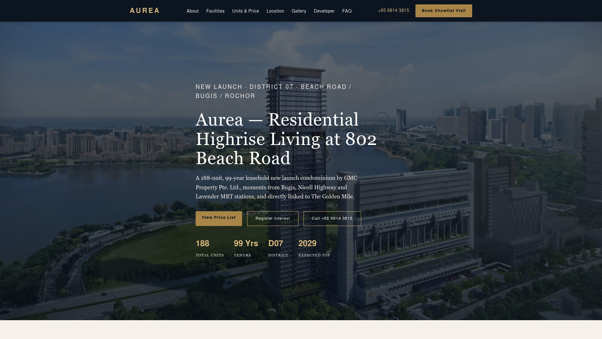
A completed Circle Line makes location decisions easier, not harder, and Aurea sits right in that sweet spot. Aurea is a new condominium offering 2 to 5 bedroom layouts plus two penthouses, all within walking distance of multiple MRT lines that connect straight into the network CCL6 just finished closing.
That connectivity isn't a minor perk. With the Circle Line now running as a full loop, residents near a well-linked station gain access to the CBD, the southern corridor, and the rest of the island without the transfer headaches commuters faced before July 2026. For families and professionals weighing where to settle for the next decade, that kind of access tends to matter more than square footage on a floor plan.
The condominium's resort-style amenities span multiple levels, and it offers a link bridge to The Golden Mile, adding a layer of convenience not common in all new launches in the area. Pricing for the 2 Bedroom units runs from $1,770,000 to $2,075,800, with larger layouts available for bigger households. If improved MRT access near Beach Road is on your shortlist, check current floor plans and book a viewing appointment at the Aurea landing page.
Sources
For anything time-sensitive, go straight to the source rather than relying on a snapshot in an article. Circle Line Stage 6 details, timetables, and service alerts change faster than any single guide can track.
- LTA | Circle Line 6 (CCL6)
- MOT | Opening remarks by Acting Minister for Transport Jeffrey Siow at Circle Line 6 public preview
FAQ
Will the Circle Line be closed in 2026?
No. Circle Line Stage 6 opened for full passenger service on July 12, 2026, and the entire loop, all 33 stations across 39.5 kilometers, is now operational. There's no planned closure tied to the CCL6 launch itself.
What are the stations on the Circle Line MRT in Singapore?
The Circle Line now runs through 33 stations forming a complete loop, including the three newest additions: Keppel (CC30), Cantonment (CC31), and Prince Edward Road (CC32). Marina Bay and Bayfront were renumbered into the CC33/CC34 sequence as part of the loop completion.
Why is there no NS6?
This question typically confuses the North South Line's numbering with the Circle Line's stage naming. "Stage 6" refers to the sixth construction phase of the Circle Line, not a station code on the North South Line, and the two numbering systems aren't related.
What is the status of the Singapore MRT Circle Line extension?
The extension is complete. Circle Line Stage 6 finished construction, held a public preview on July 4, 2026, and entered full passenger service on July 12, 2026, closing the loop after roughly three decades of planning.