
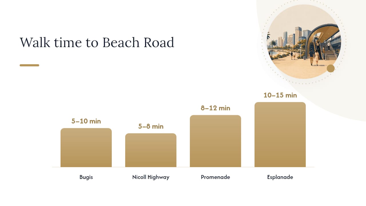
If you're heading to Beach Road, four MRT stations get you there: Bugis for mid to north Beach Road and the Golden Mile stretch, Nicoll Highway for the eastern end near Suntec and Golden Mile Complex, and Promenade or Esplanade for the southern stretch toward Marina Centre. Which one wins depends entirely on which building number you're walking to, not which station looks closest on a map.
Beach Road runs roughly from Jalan Sultan to Raffles Boulevard, and that length is exactly why "just take the MRT to Beach Road" isn't useful advice on its own. The Land Transport Authority (LTA) runs four different lines within walking distance of some part of this road, and the URA Draft Master Plan has spent the last several years pushing developers to connect those stations to the street with covered walkways instead of leaving pedestrians to dodge traffic and rain.
Here's the shortlist, station to best for walking time:
- Bugis MRT (East-West Line / Downtown Line): best for mid to north Beach Road, Golden Mile, Shaw Towers area. About 5 to 10 minutes on foot.
- Nicoll Highway MRT (Circle Line): best for the eastern stretch near Golden Mile Complex and Suntec approach. Around 5 to 8 minutes.
- Promenade MRT (Downtown Line / Circle Line): best for southern Beach Road toward Marina Centre and Suntec City. Roughly 8 to 12 minutes.
- Esplanade MRT (Circle Line): best for the far southern end near Raffles Boulevard and the Esplanade precinct. Around 10 to 15 minutes, often via sheltered links.
- Jalan Besar or Lavender MRT: useful alternatives if you're at the Jalan Sultan end, though both require a longer walk than the four stations above.
Check TransitLink or MyTransport.SG before you leave. Both show live exit maps, which matter more here than almost anywhere else in the city because Beach Road's building numbers don't map cleanly to any single station.
Key Takeaways
Beach Road's MRT connectivity depends less on straight-line distance to a station and more on which sheltered walkway and exit connect to your exact address.
| Point | Details |
|---|---|
| Match station to address | Use Bugis for mid/north Beach Road, Nicoll Highway for the eastern Golden Mile stretch, Promenade or Esplanade for Marina Centre and the south. |
| Exit letter matters | Check TransitLink's station map PDFs for exit letters before you travel, since the wrong exit can add an unsheltered detour. |
| Confirm fares before you go | Run your exact trip through the LTA fare calculator rather than estimating, since Singapore's transit fares are distance-based. |
| Favor through-block links in rain | Choose routes flagged as sheltered or through-block, especially via Bugis+, Golden Mile Complex, or Suntec City, during wet weather. |
| Factor connectivity into a purchase | Aurea at 802 Beach Road links directly into this sheltered network via its Golden Mile bridge, making station access part of the property's daily value. |
Table of Contents
- Station-By-Station Reference for Beach Road Access
- How to Get from Common Starting Points to Beach Road
- Sheltered Walkways and Accessible Routes Near Beach Road
- Which Apps and Tools Actually Help You Plan the Trip
- Why Beach Road's MRT Connectivity Actually Matters
- Considering a Home Right on Beach Road?
- Sources
Station-By-Station Reference for Beach Road Access
Each station on this list connects to Beach Road differently, and the difference between using the right exit and the wrong one can cost you ten minutes and a soaking in a thunderstorm. Here's the breakdown.
| Station | Lines | Walk to Beach Road | Best exit | Sheltered route | Nearby buses | Accessibility |
|---|---|---|---|---|---|---|
| Bugis | EWL, DTL | 5–10 min | Exit D or B | Partial, via Bugis+ mall | 12 | Lifts at all exits, barrier-free |
| Nicoll Highway | CCL | 5–8 min | Exit A | Mostly sheltered via Golden Mile Complex link | 31 | Lift access, tactile paving |
| Promenade | DTL, CCL | 8–12 min | Exit A or C | Sheltered via Suntec City link | 36 | Lifts, ramps at all exits |
| Esplanade | CCL | 10–15 min | Exit B | Sheltered via CityLink Mall underpass | 106 | Full barrier-free access |
| Jalan Besar | DTL | 12–15 min | Exit A | Largely unsheltered | 2, 12 | Lift access, no underpass link |
Bugis is the interchange most people default to, and for good reason. It's an interchange station on the East-West and Downtown lines, sitting under the junction of Rochor Road and Victoria Street, which makes it the nearest interchange for central Beach Road addresses. Moovit's own walking-time data pegs it as roughly a five-minute walk to 38 Beach Road, which lines up with what most locals will tell you if you ask.
Nicoll Highway sits closer to the Golden Mile stretch, and its Circle Line connection makes it the better pick if you're coming from the east side of the city (Kallang, Paya Lebar direction) rather than transferring through Bugis. Exit A puts you almost directly onto the Golden Mile Complex walkway.
Promenade and Esplanade both serve the southern end of Beach Road, but they're not interchangeable. Promenade sits closer to Suntec City and the Beach Road/Nicoll Highway junction, while Esplanade favors anyone heading toward Raffles Boulevard or the waterfront. Both connect to indoor mall networks, which matters a lot more than it sounds like during a downpour.
Jalan Besar and Lavender, per Moovit's Beach Road transit listings, work if you're at the Jalan Sultan end of the road, but neither has the sheltered infrastructure the four main stations do. Hotel operators on the road, including PARKROYAL on Beach Road, point guests toward Bugis and Nicoll Highway first, which tells you something about which stations locals and frequent visitors actually rely on.
How to Get from Common Starting Points to Beach Road
Route planning for Beach Road comes down to knowing which interchange to use and which exit saves you the walk. Here are four routes that cover most trips people actually make.
From Bugis to 38 Beach Road
- Exit at Bugis MRT via Exit D.
- Walk through Bugis+ mall toward Victoria Street.
- Cross at the signalized junction onto Beach Road. Expected time: 8 to 12 minutes door to door.
From City Hall to southern Beach Road (Marina Centre)
- Take the North-South or East-West Line to City Hall.
- Transfer to the Circle Line toward Esplanade or Promenade (one stop).
- Exit via the sheltered mall link toward Suntec City. Expected time: 12 to 20 minutes including the transfer.
From Orchard to Beach Road
- Take the North-South Line toward Dhoby Ghaut.
- Transfer to the Circle Line toward Promenade or Esplanade.
- Alternatively, transfer at City Hall to reach Nicoll Highway if your destination is the Golden Mile end. Expected time: roughly 20 to 30 minutes depending on the transfer wait.
From Changi Airport to Beach Road
- Take the Downtown Line directly from Changi Airport (via Expo transfer) toward Bugis.
- Alight at Bugis and use Exit D.
- Walk the remaining 5 to 10 minutes to your address. Expected time: around 45 to 55 minutes, depending on train frequency.
Fares for all these trips vary by exact distance, so run your specific origin and destination through the LTA fare calculator rather than relying on a flat estimate. Short CBD hops are inexpensive, but the calculator accounts for distance-based pricing that a rough guess won't get right.
A few practical notes worth keeping in mind:
- Bugis gets crowded fast between 8:00 and 9:15 AM and again from 6:00 to 7:00 PM, since it's a major interchange for two lines at once.
- If Bugis feels packed, City Hall to Circle Line is often the calmer transfer, even though it adds a station.
- Weekday lunch hours typically see increased passenger traffic around Promenade and Esplanade stations, influenced by nearby office developments.
Sheltered Walkways and Accessible Routes Near Beach Road
Beach Road's pedestrian network isn't an accident. URA's guidance under circular DC19-19 directs new developments along this stretch toward continuous covered walkways, underground links, and through-block connections, specifically so pedestrians aren't stuck crossing open roads in tropical downpours. The revised Street Block Plans covering Beach Road, Tan Quee Lan Street, North Bridge Road, and Seah Street push this further, requiring new construction in those blocks to build pedestrian networks at multiple levels, not just at street grade.
In practice, this means URA's technical guidelines specify Urban Pedestrian Network links of at least 6.0 meters wide with minimum clear internal height requirements, which sounds like planning jargon until you're walking through one on a rainy Tuesday and realize you haven't opened your umbrella once.
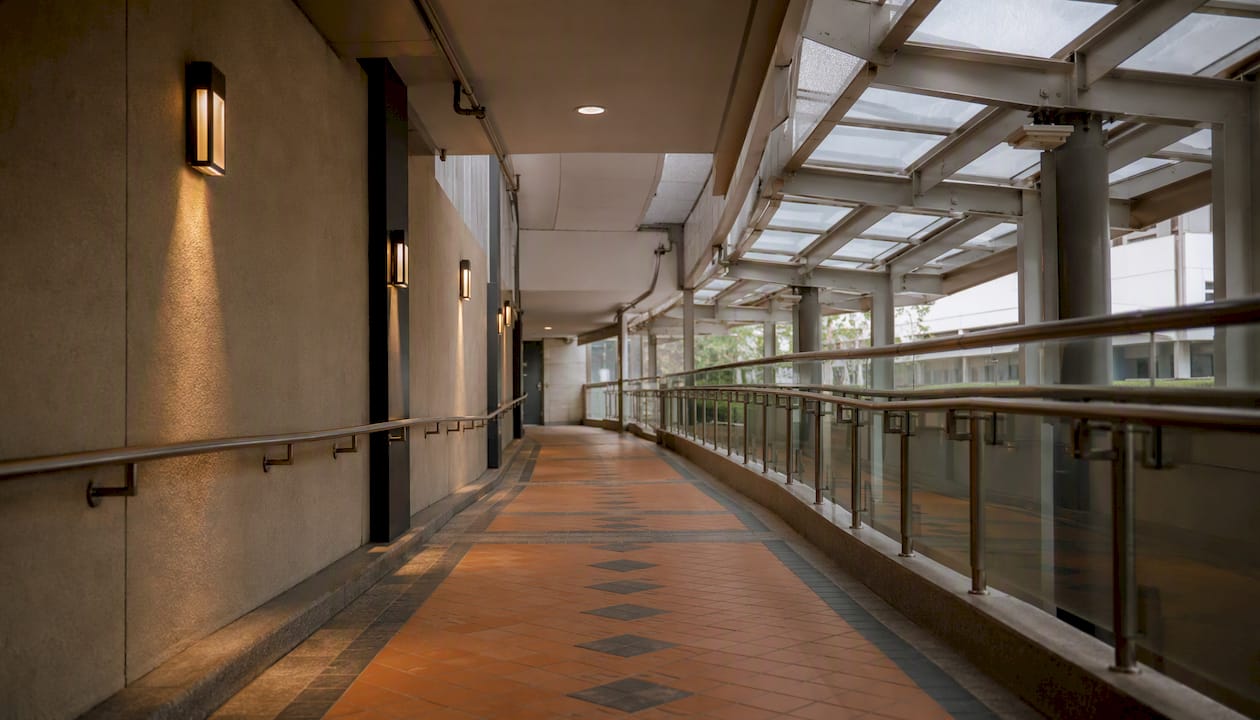
Continuous covered walkways and through-block links aren't a nice-to-have for Beach Road. They're the reason a five-minute walk from Bugis stays a five-minute walk in a thunderstorm instead of turning into a ten-minute detour under shop awnings.
The most useful sheltered connections right now run through Bugis+ mall (linking Bugis MRT to Victoria Street), the Golden Mile Complex walkway (linking Nicoll Highway to the eastern stretch), and the Suntec City and CityLink Mall underpasses (linking Promenade and Esplanade to southern Beach Road and Marina Centre). Accessibility-wise, all four main stations have lifts and barrier-free paths, though Jalan Besar lacks the underpass links the others have, so wheelchair users and anyone with a stroller will find the Golden Mile route from Nicoll Highway noticeably easier than surfacing near Jalan Besar and crossing at street level.
Pro Tip: If you want the shortest sheltered path to the Golden Mile stretch, use Nicoll Highway's Exit A and walk through the Golden Mile Complex link rather than surfacing onto Beach Road directly. It shaves off the one open-air crossing that trips up most first-time visitors.
Which Apps and Tools Actually Help You Plan the Trip
Four tools cover almost everything you need, and each does a different job.
- LTA's rail network page is the source for line maps, service updates, and station listings. Use it when you need to confirm which lines run where before anything else.
- TransitLink / MyTransport.SG gives you official station maps with labeled exits, which matters enormously on Beach Road since exit choice determines whether you get a sheltered walk or a rain-soaked one.
- Google Maps handles live walking times and transit overlays best, especially for checking real-time train delays or comparing a walking route against a bus alternative.
- Moovit is strongest for bus stop micro-data, showing exactly which bus numbers stop closest to a specific Beach Road address, which is genuinely useful if the nearest MRT exit is still a longer walk than you'd like.
Before you leave, run through a short checklist: confirm your exit letter on TransitLink's station map PDF, check whether rain is forecast and pick the sheltered route if so, verify lift availability if you need step-free access, and time your trip to dodge the two peak crowd windows around Bugis if you can.
Why Beach Road's MRT Connectivity Actually Matters
Most guides treat MRT proximity as a checkbox: near a station, good; far from one, bad. That's lazy thinking, and Beach Road is a perfect example of why. What actually matters isn't distance in meters, it's whether the walk is sheltered, whether the exit lines up with where you're going, and whether the corridor is designed to move people, not just trains.
URA's own planning language for this precinct treats Beach Road as a connector between City Hall, Marina Centre, and Bugis, not as a standalone strip. That framing changes how you should think about buying or renting here. A unit that's a "seven-minute walk" from Bugis through an air-conditioned mall link is a genuinely different daily experience than a seven-minute walk along an exposed five-foot-way, even though both show up identically on a map with a walking-distance radius drawn around them.
There's a practical wrinkle here too: picking a station by which side of Beach Road your address sits on, rather than which station looks geographically closest, often gets you home faster. One-way streets and pedestrian crossings around this precinct can add several minutes that a straight-line distance estimate never accounts for. That's the kind of detail that only shows up once you've actually walked the route a few times, not from staring at a transit map.
Considering a Home Right on Beach Road?
Everything above matters more once you're picking where to live, not just where to visit. A short, sheltered walk to Bugis or Nicoll Highway isn't a convenience feature. It's the difference between a ten-minute door-to-desk commute and a twenty-minute slog through traffic crossings, every single workday for years.
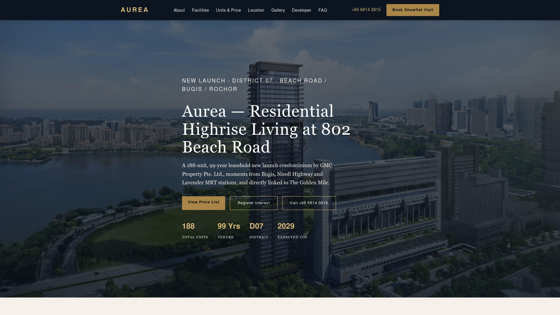
Aurea sits at 802 Beach Road, within that same walkable network this guide has been describing, with a link bridge to The Golden Mile that plugs directly into the sheltered pedestrian routes toward Nicoll Highway. The development's 188 units, ranging from two to five bedrooms plus two penthouses, are built for exactly the kind of resident who cares about door-to-station time as much as square footage. If you've read this far because you're weighing a move to the area, not just passing through it, that's worth factoring into the decision. For a closer look at what's driving demand along this stretch, our breakdown of Beach Road condos and the broader CBD condo market covers the buying side in more detail. If long-term ownership planning is part of your thinking, property trust structuring is worth a look too. Visit the Aurea project page to check current unit availability or arrange a site-plan walk-through with the sales team.
Sources
- Rail network | Land Transport Authority (LTA)
- How to Get to 38 Beach Road in Singapore by Bus, Metro or MRT & LRT? | Moovit
- Bugis MRT station — Wikipedia